Geospatial Engineering Bachelor's Degree

What if you had a high-tech job, but spent your work day outside, enjoying nature and fresh air each day? If you like computing and the great outdoors, you may excel at geospatial engineering.

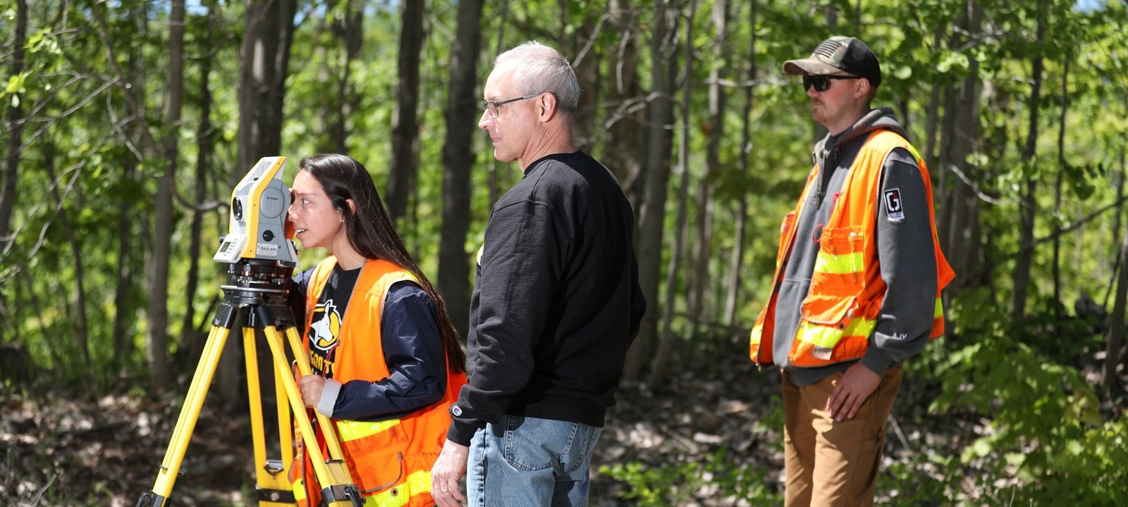
As licensed professionals, our faculty provide students with real world experiences. Studying geospatial engineering is both an adventure and a learning experience. Geospatial engineers are surveyors. They measure the physical features of the Earth with great precision and accuracy. Geospatial engineers calculate the position, elevation, and property lines of parcels of land.

Our students learn about geospatial systems and spatial data acquisition technologies. Such methods rely on high-precision optical and electromechanical instruments. Learn satellite and aerial remote earth observation systems. Use aerial and terrestrial lidar, as well as Global Navigation Satellite Systems (GNSS). Our curriculum includes the use of Unmanned Aerial Systems (UAS) and High Definition Surveying. Become familiar with Geographic Information Systems (GIS). Try out traditional surveying technologies and other options in the geospatial engineering toolbox.

The Bachelor of Science in Geospatial Engineering orients you for the state professional surveyor's exam. Geoinformatics topics include GIS, photogrammetry, and remote sensing. Professional surveying prepares students to become State Licensed Professional Surveyors. A core focus is the accurate location of real property boundaries. This includes data capture of the natural/man-made objects on the earth's surface. We often use methods of digital mapping in design or planning.

 
  • 12
    out of 20 universities with the greatest salary impact
  • 2
    out of 38 best colleges in Michigan
  • A
    for value and professors
  • 2x2
    double wage, double growth for STEM occupations

What is Geospatial Engineering?

Geospatial engineering is a field that combines principles of engineering, geography, and surveying to collect, analyze, and manage spatial data.

It involves the use of various technologies such as Geographic Information Systems (GIS), Global Positioning Systems (GPS), remote sensing, and computer-aided design (CAD) to capture, store, manipulate, analyze, and visualize geographic information.

Geospatial engineers work on projects related to land surveying, mapping, urban planning, environmental assessment, infrastructure development, disaster management, and natural resource management. They use their expertise to create accurate maps, models, and databases that help in decision-making processes for various industries including transportation, agriculture, telecommunications, and urban development. 

Geospatial engineering plays a crucial role in understanding and managing the spatial aspects of our world, enabling better planning, resource allocation, and problem-solving.

Common applications include mapping and measuring various aspects of the earth.

Tomorrow Needs Geospatial Engineers

Many different industries need the expertise of geospatial engineers. You can work with architectural  and engineering firms. Collaborate with government and real estate agencies. Share a project with mining companies. Industries also rely on the geospatial data and products that geospatial engineers provide. The need is increasing with advances in technology.

Jacob Wysko on Geospatial Imagery

Ever since I was young, I’ve always had a keen interest in mapmaking and cartography. I liked to make detailed maps of the house and property that I grew up in. Finding out that there is a degree and career based around making detailed and accurate surveys really sparked my interest.

Jacob Wysko
Jacob Wysko ‘24
geospatial engineering

Be Career-Ready

With a 100% job placement rate for graduates, you'll be ready to engineer a better tomorrow. Learn field practice, boundary law, and geospatial monitoring. Practice geoinformatics, GPS, GIS, and photogrammetry. Use geodesy, spatial data adjustments, remote sensing, and hydrographic surveying. Tomorrow needs geospatial engineers who can measure, model, and perform. Be agile on the job from day one. We're ready. Are you?

Explore career opportunities for geospatial engineers.

  • Professional Surveyor
  • Geographic Information Systems Professional (GISP)
  • Photogrammetrist (CP)
  • Surveying Engineer
  • Geospatial Engineer

$50,984 mean entry-level salary
Figures from payscale.com, accessed May 2024.

Ready to take the next step?

Learn more about studying geospatial engineering at Michigan's flagship technological university.


Connected, innovative.

Build real skills at Michigan Tech. Become an engineer.

Gain diverse experience.

Engage in design and research.

Leap forward in your program.

Connect with students and industry.

Jacob Heck
“Sitting at a desk job from 9 to 5 never truly appealed to me; I was looking for a career that would fulfill my need for adventure and allow me to spend time outdoors.”Jacob Heck '10, Geodesist at National Geodetic Survey

Be an MTUengineer

Join the LEAP leaders, wow the elementary students, and attend the AIPG National Conference.

Teach coding and circuitry. Research combustion and nanotechnology. Do a co-op with Kimberly-Clark. Show us how to slurry sand and complete miners training.

Tell us how important wetland mitigation is to you.

This is what we're all about.

Read Student Stories

A Professional Start

Geospatial engineering majors have great peers.

  • National Society of Professional Surveyors
  • Engineers Without Borders
  • MTU Society of Women Engineers
  • Green Campus Enterprise

Compete in Enterprise. Explore the MTU GeoPortal.

Begin your networking journey here.

Join clubs and groups.


Beyond Engineering

Engineering majors cultivate their interests and talents at Michigan Tech. Join Superior Wind Symphony, follow military service, and be active in local politics.

Dive into Yucatan Culture.

Attend GeekU.P., become a lifeguard, and do a Canal Run. Be a musher. Set a Guinness World Record. Take part in Parade of Nations.

Let yourself shine.

Go Beyond

The CEGE Department

  • Learn from top faculty who are experts in structural, environmental, highway, construction management, and other engineering areas.
  • We teach sustainable engineering practices.
  • Try our pilot-scale environmental simulation lab.
  • Experiment with asphalt and other civil engineering materials.
  • Find out about our innovative Rail Transportation Program.
  • You will receive the personal attention and support necessary for academic success.

MTU engineering

Real Engineering. Meaningful Work.

We are committed to inspiring students, advancing knowledge, and innovating technological solutions to create a sustainable, just, and prosperous world. With an entering engineering class of about 1,000 students, 17 degrees to choose from, and 160 faculty in the College of Engineering alone, we provide a world-class education with the trusted reputation of Michigan Tech.

As a student at Michigan Tech you’ll work closely with faculty mentors, immerse yourself in experience-powered learning, and gain a thorough understanding of engineering practice. Collaborate and innovate in laboratories, coursework, Enterprise, and Senior Design—you'll work with industry partners on real engineering projects and develop strong skill sets for your future.

You could study abroad, with engineering opportunities ranging from a few weeks to one full year. Or focus on problems facing disadvantaged communities in countries around the world. Michigan Tech’s Global and Community Engagement program offers you a range of options.

More than 400 employers regularly recruit our students for internships, co-ops, and full-time employment. Engineering students average seven interviews, and 98 percent are employed within their field of study, enlist in the military, or enroll in a graduate school within six months of graduation. A degree in engineering from Michigan Tech can take you anywhere.

Tomorrow Needs You

Engineers do a lot of things, but there's one thing we do first and foremost: we help people. We use creative ideas and technologies to solve problems in health care, energy, transportation, hunger, space exploration, climate change, and more—much more. Become an engineer who is ready for what tomorrow needs.

Student Stories

“There is a shortage of professional surveyors, who must have a four-year degree and pass a state licensure exam. Only two Michigan colleges offer a bachelor’s degree — Michigan Technological University in Houghton, with which NMC has a transfer agreement, and Ferris State University.”Traverse City Record Eagle