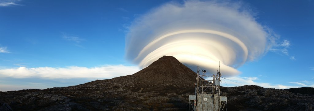
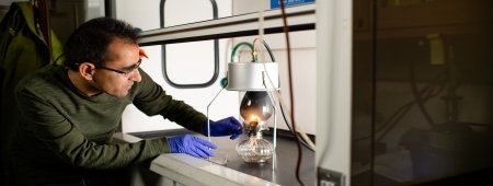
How far have you gone for science? Andrea Baccarini scaled Pico Mountain, a dormant volcano in the Azores, in the name of good research. Well, clean and clear research. He explains why in this guest blog.
Descending the flank of Pico Mountain—in the middle of the night, in the midst of a storm with rain, strong wind, and fog, all with a twisted ankle—my main thought was "Why did I decide to work on this crazy project?"
The thought weighed on me heavier than my 55-pound backpack. And it was valid. Why did I choose to climb a mountain to characterize a bunch of remote aerosol particles?
To answer that, I have to introduce myself. I am an Italian student who recently obtained a master’s degree in experimental physics from the University of Trento. The project, my master’s thesis, focused on the vertical characterization of aerosol properties across the flank of the Pico Mountain in the Azores.
In other words, I wanted to understand how particles in the air change their properties with height and in which way this influences their interaction with sunlight. Pico is the place to do just that.
Field Campaign
Pico is a stratovolcano in the Azores, it is 2,350 meters (7,710 ft.) tall and offers a unique location to investigate how aging and cloud processing modify aerosol properties. A climatological and environmental station, Pico Mountain Observatory (PMO), was installed by the late Michigan Tech professor Richard Honrath and by professor Paulo Fialho from the university of the Azores in 2001 to investigate long range transport of trace gases. Moreover, over the last four years, Claudio and Lynn Mazzoleni performed extensive measurements of aerosol properties exploiting the uniqueness of the site.
I joined them during the 2015 field season for two months. This was what I had to hike with.
And the hiking is worth it: Pico is a unique place to study aerosols.
Aerosols are tiny particles suspended in the atmosphere that interact with incoming solar radiation and outgoing infrared. These interactions affect the overall radiative budget contributing to climate change. Aerosol properties are still largely unknown and a large effort is being carried out by the scientific community to obtain a better understanding of their properties and to create climate models to account for their effects.
Hiking to the Top of the World
I met Claudio thanks to a talk that he gave to students of Dino Zardi, professor of atmospheric physics at the University of Trento. A significant part of the talk was devoted to the description of Pico and I was immediately impressed by the description of this location. I was attracted by the unique position of this site and fascinated by the idea that the station could be reached only after a seriously long hike. At the same time I was intrigued by the idea of performing new measurements and the possibility to put my own little brick on the big wall of aerosol knowledge, that is actually under construction.
From the window of the plane landing on the island, I immediately noticed the top of Pico Mountain, a quasi perfect cone emerging from the ocean and dominating the surrounding land.
Pico is different from all the mountains that I am used to, it is different for its shape, for its darker color and in particular for its complete isolation.
"Straddling the top of the world, one foot in China and the other in Nepal, I cleared the ice from my oxygen mask, hunched a shoulder against the wind, and stared absently down at the vastness of Tibet. I understood on some dim, detached level that the sweep of earth beneath my feet was a spectacular sight..."Jon Krakauer, Into Thin Air
I understood that feeling on top of Pico.
Reaching Pico's summit, looking at a horizon made only of water and air while realizing how vast the surrounding ocean is, stimulates feelings that are probably similar to those created by the view from the top of Mount Everest.
The isolation and the elevation were two of the main reasons the PMO was established here, in fact the station typically lays above the atmospheric Boundary Layer (we'll shorten to BL), the part of the atmosphere that is directly influenced by the presence of the surface. The separation enables us to measure gases and aerosols in the Free Troposphere (FT). These gases and aerosols can be transported over long distances and here, in the Azores, we frequently measured air masses coming from North America.”
Making Sense of the Atmosphere
One of the main goals of my thesis was to investigate two circumstances. One, whether the station effectively lays above the BL. And, two, to figure out when and under which conditions boundary layer aerosols rather than FT particles are measured at the station.
The answer to the first question is that, during the summer, in 100 percent of the cases, the station was found to lay well above the boundary layer. The second question is trickier and any general conclusion would be questionable since a variety of different processes may arise. The BL is not an impenetrable barrier. For example, a buoyant push off the mountain could drive low BL particles up into the FT or particles could subside down.
With the backpack profiles, it was possible to identify 13 vertical maps with a well-defined transition between the FT and the BL. We found that in 70 percent of cases the average size of the particles in these two regions of the atmosphere was different. In the 2014, aerosols were found to be smaller in the BL while in the 2015 the opposite trend was found. This suggests that a separation between the two layers effectively exists.
By looking at the average size of the particles we identified four possible cases of mixing between FT and BL air. Two of these events were probably intrusions of air masses from the FT into the BL; in one case air from the BL was probably lifted to the FT.
Why Pico Matters
This is what it boils down to: We study the air we breathe and the changing climate at Pico.
Better knowledge of the vertical distribution of aerosol properties can improve the accuracy of the radiative transfer models and consequently reduce uncertainties related with future climate prediction. The Azores position is representative of North Atlantic Ocean mid-latitudes, a wide region where only a couple of sites dedicated to aerosol studies exist. With these ongoing measurements pieced together at PMO, it's possible to fill a big gap in climate models. We can advance toward a more complete characterization of aerosol properties over this wide area. Keep in mind, my results are preliminary, and a lot of work is still required, but they're a first step.
Also, irrespective of aerosol impact on climate, backpack profiles together with measurements at PMO offer valuable insights into aerosol physics. How does atmospheric circulation affect aerosol transport? What are their interactions with the clouds? And how do they evolve after moving for several days into the FT?
Lines in the Clouds
A noticeable example that falls into the first category is the formation of a thin layer of aerosol in the FT just above the clouds. These layers appear as a sharp dark line at the horizon and we frequently observed them during the field campaign. These layers are probably made by aerosols produced and then transported over long distances that reside in the FT for long periods of time since there is no turbulence to dissipate them.
Usually, there is just one of these layers. But on June 26, 2015, we observed a triple layer.
They were plainly visible and the instrument inside my backpack also picked up on them. In particular the particle concentration data clearly shows the presence of two layers and probably a third layer that was not measured only because it was laying above the top of Pico mountain.
Coming Down Off the Mountain
So, why did I decide to work on this crazy project? To me, the answer is as clear as the view from atop Pico on a sunny day. I chose this project for its importance and the uniqueness of the research that can be done here, for the breathtaking location and, a posteriori, I would say for the people.
In fact, due to the experience on Pico, I had the opportunity to collaborate with an international team of scientists and to grow from a scientific point of view. In particular living and working in close contact with Claudio and Lynn Mazzoleni made me learn a lot of new things. They have been wonderful hosts and I sincerely want to thank them for caring so much about me and my future career as a scientist.
And now what is the future of the project? Claudio and Kaelan (a student from Michigan Tech) climbed Pico recently to open the station for the new season. And, hopefully, Kaelan will be able to continue with backpack profiles, adding a third year of data to our records.
Concerning my future, I will apply for a PhD in Italy at CNR in Bologna with a project that will be based on the creation of a network between PMO and another mountaintop monitoring station, Monte Cimone, in Italy. A lot of questions are still open and we want to address them and to keep PMO operative, so stay tuned.
Michigan Technological University is an R1 public research university founded in 1885 in Houghton, and is home to nearly 7,500 students from more than 60 countries around the world. Consistently ranked among the best universities in the country for return on investment, Michigan's flagship technological university offers more than 185 undergraduate and graduate degree programs in science and technology, engineering, computing, forestry, business, health professions, humanities, mathematics, social sciences, and the arts. The rural campus is situated just miles from Lake Superior in Michigan's Upper Peninsula, offering year-round opportunities for outdoor adventure.


Comments