
Geospatial engineering combines principles of engineering, geography, and surveying to collect, analyze, and manage spatial data. Geospatial engineering involves surveying. Over time, the field of surveying has evolved and grown due to the use of new technology and tools. The occupation and field of study are now known as geospatial engineering.
What Do Geospatial Engineers Do?
Geospatial engineering plays a crucial role in understanding and managing the spatial aspects of our world, enabling better planning, resource allocation, and problem-solving.

Geospatial engineers use various technologies such as Geographic Information Systems (GIS), Global Positioning Systems (GPS), remote sensing, and computer-aided design (CAD) to capture, store, manipulate, analyze, and visualize geographic information.
Geospatial engineers work on projects related to land surveying, mapping, urban planning, environmental assessment, infrastructure development, disaster management, and natural resource management. They use their expertise to create accurate maps, models, and databases that help in decision-making processes for various industries, including transportation, agriculture, telecommunications, and urban development.
Geospatial engineers measure the physical features of the Earth with great precision and accuracy, calculating the position, elevation, and property lines of parcels of land. They verify and establish land boundaries and are key players in the design and layout of infrastructure, including roads, bridges, cell phone towers, pipelines, and wind farms.
In the geospatial engineering field, a myriad of equipment has been used over the years to determine locations and boundaries. From lower-tech theodolites to high-tech drones, satellite technology, GPS, and GIS, all are used to accomplish this task.
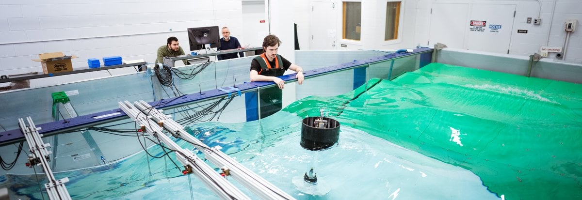
What Careers Are There in Geospatial Engineering?
All land-based engineering projects begin with surveying to locate structures on the ground. As a result, numerous industries rely on geospatial data and products that geospatial engineers provide. With advances in technology, the need is increasing, too—with geospatial engineers employed by companies including architectural firms, engineering firms, government agencies, real estate agencies, mining companies, and others.
Out in the field, geospatial engineers use numerous tools, including robotic total stations, GPS receivers, scanners, lidar, unmanned aerial vehicles (UAVs or drones), and many others. These are the tools of the trade.
Advances in GPS technology have led to the use of GIS for mapping, as well as geospatial data capture and visualization technologies. Geospatial engineers also use virtual reality integration, Structure from Motion (a technique which utilizes a series of two-dimensional images to reconstruct the three-dimensional structure of a scene or object, similar to lidar), and drones.
There is an ongoing demand for geospatial engineers. Jobs are open and can't be filled fast enough. A great need exists for those with an interest and aptitude for the profession.
What Skills Do Geospatial Engineers Need?
Students who enjoy and excel at math, geography, and critical problem-solving do well in geospatial engineering. An understanding of environmental and geographic principles is fundamental for prospective geospatial engineering students. Spatial thinking is an important skill for geospatial engineers; this skill involves understanding spatial relationships, visualizing spatial data, and solving problems related to geography and spatial distribution.
Geospatial engineers rely on their analysis skills to acquire, analyze, interpret, and present geographic and spatial data. As geospatial engineers are frequently handling large datasets, detail-oriented skills can help with data validation, error checking, and quality assurance of geospatial outputs. Geospatial engineers are also project managers and require expertise in planning, coordinating, and executing projects on time, frequently in collaboration with multiple team members and stakeholders.
Specifically, geospatial engineers are trained in technical proficiency of geospatial technologies like GIS, remote sensing technology, and surveying equipment. Geospatial engineers use statistical and computational methods to process and interpret data, and are also skilled in communications and design in order to visualize and present spatial data.
What Tasks Do Geospatial Engineers Do?
Geospatial engineers put spatial understanding and technical skills to work in a variety of industries. Geospatial engineers often find themselves working in a dynamic and collaborative environment, which often includes both traditional office settings and the field. Example of places where geospatial engineers work include:
- Architectural and engineering firms
- Urban planning offices or urban development agencies
- Real estate agencies
- Government agencies in transportation, agriculture, or telecommunications
- Mining companies and land-development agencies
- Civil engineering firms or research organizations
- Companies who develop 2D or 3D maps of building plans, archaeological sites, or national parks
- Companies who develop innovative geospatial and geographic technologies
How Much Do Geospatial Engineers Earn?
The median entry-level annual salary for a geospatial engineering graduate with one to four years of experience is $41,956, according to Payscale. The mean annual salary is $78,810, according to the US Bureau of Labor Statistics, which also reports that the top 10 percent in the geospatial engineering field earn $113,540.
Job prospects are good, with a faster than average growth rate of 6 percent in the next decade.
Figures from payscale.com, accessed December 2024
Figures from US Bureau of Labor Statistics (BLS), dated December 2024
See additional engineering salary information.
The Future of Geospatial Engineering
The field of geospatial engineering has been around since ancient times; cartography dates back to the B.C. era. From then until the mid-18th century, technology evolved from hand-drawn maps to the magnetic compass, telescope, and sextant used to determine latitude and longitude.
The development of photography in the 19th century advanced the collection and use of geospatial information. Aerial photography began as early as the 1860s using cameras attached to balloons, kites, and even birds. In the mid-20th century, satellites were launched for surveillance, cartography, and communications.
In the 1970s, the inventions of both the total station—an instrument used to measure distance and vertical and horizontal horizons—as well as GPS technologies made geospatial technology more widely accessible.
Today, geospatial engineering and technology has applications in transportation, meteorology, agriculture, and urban planning.
In the future, geospatial engineering will play an important role in automation, from remote sensing in automated vehicles and remote-controlled equipment, to geospatial data used in artificial intelligence and machine learning. Geospatial engineering will continue to aid work in fields such as construction, sustainability, agriculture, transportation, and more. Geospatial engineering and geospatial engineers are needed in practically every field as geospatial data becomes more and more implemented into everyday life.
Pursuing a Geospatial Engineering Degree
There are several paths you can take that lead to a career in a geospatial engineering profession. Most entry-level positions require at least a bachelor's degree in a related field. Our undergraduate academic advisor, Julie Ross has some additional tips to help you prepare if you want to pursue a degree in a geospatial engineering field.
Tips for High School Students

If you're currently in high school and are considering getting into a geospatial engineering field, here are some helpful steps you can take:
- Focus on your math and science classes, as these will form the basis for your engineering education. Courses related to statistics may also help. Your enjoyment (or not!) of these courses could tell you a lot about whether or not geospatial engineering may be right for you.
- Read overviews of different engineering degrees to get a sense for which one you may want to pursue.
Choosing a College/University for Geospatial Engineering
Selecting a school to study a geospatial engineering field isn't easy. These tips can help you decide:
- >Do research to learn about colleges and universities that would put you on a successful path. It's not necessary to major in a program called geospatial engineering to have a successful career in this industry! Look for degrees that fall under the geography and engineering umbrella.
- Make sure the schools you're considering offer accredited degrees, since most employers will only consider graduates from such institutions.
- Visit the schools you're interested in and ask lots of questions about the programs, scholarships and financial aid opportunities, and application requirements and deadlines.
- Apply to the schools you think are the right fit for you and your goals sometime between your junior year and the beginning of your senior year. Track deadlines on a calendar so you don't miss them.
Tips for College Students
- If you're currently in college, our College of Engineering advisor offers these tips to help ensure your success in the geospatial engineering field of your choice:
- Work with your academic advisor to choose the appropriate program and courses that will give you the necessary knowledge and skills for a career in a geospatial engineering field.
- Gain experiences in real surveying or projects. Look for opportunities through student organizations, professional conferences, co-ops and internships, and research projects at your institution.
- Form relationships with faculty members in your program. These connections will help you as you look for relevant geospatial and geographic experience during and after your college career.
- Network with professionals. Whether you're at a conference or an on-campus career fair, seize every opportunity to form connections with professionals in the field—you never know when they could come in handy!
- Keep your resume up to date and brush up on your interviewing skills. Your institution may even have a dedicated career center that can help you!