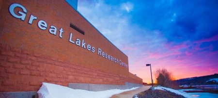
Researchers at Michigan Tech's Great Lakes Research Center are leading a collaborative effort to map the lake beds of the Great Lakes at high resolution for the first time—a giant leap forward in the protection of the region's precious freshwater resources.
On October 23, 1968, a Beechcraft Queen Air 80 airplane belonging to the National Center for Atmospheric Research (NCAR) disappeared over Lake Superior, just off the western coast of the Keweenaw Peninsula. The plane was carrying two pilots and a University of Wisconsin graduate student assistant on a routine mission to gather water radiation and temperature data in the Great Lakes region. Their last contact was with the Houghton County Memorial Airport at 12:30 p.m.
Efforts to locate the plane over the past 56 years have turned up next to nothing. In 1969, an NCAR team, assisted by four Michigan Tech students and outfitted with the best sonar equipment of the era, conducted a month-long search of a three-by-five-mile area of the lake near the community of Freda, to no avail. Such missions using conventional, manned vessels have become rare, though not entirely impossible, given their cost and the many variables leading to their low likelihood of success—the vastness of Lake Superior, the tempestuousness of the region's weather, the low-density data of existing lake bed maps of the Great Lakes, etc.
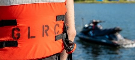
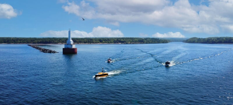
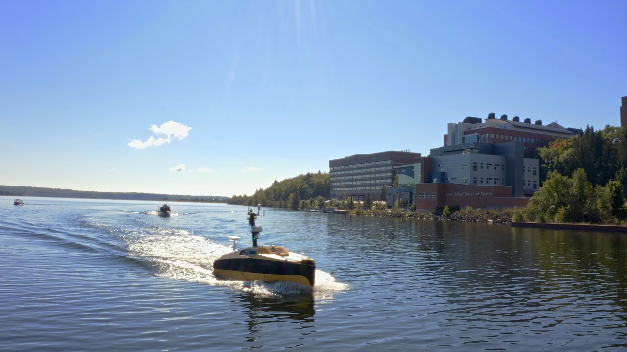
Interest in the NCAR case has gathered momentum in recent years, partly due to its connection to broader collaborative efforts to locate missing aircraft and shipwrecks while advancing our understanding of the Great Lakes' lake beds. The momentum crested late last summer, when a group of government officials and industry partners from the Smart Ships Coalition gathered on the docks at Michigan Tech's Great Lakes Research Center (GLRC) in Houghton on September 9. There, they launched a formal week-long search for the NCAR plane using some of the most advanced marine technology available: Ocean Infinity's Armada 8 autonomous surface vessel (ASV) and a pair of high-resolution wideband multibeam sonar systems from Norbit and Kongsberg.
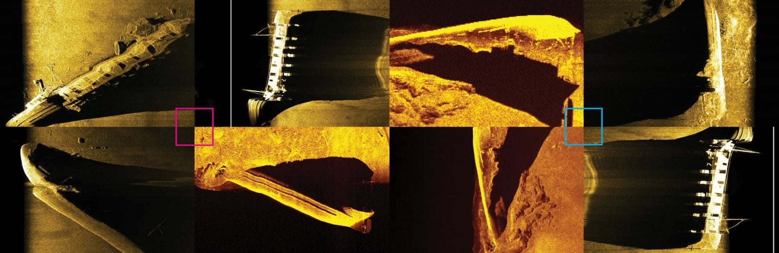
Supported by two crewed GLRC vessels, the sonar-equipped ASV planned to capture ultrahigh-resolution acoustic imagery representing the shape and depth of the lake bed over a search area of 21 square miles. Much like topography shows the forms and features of land, modern, high-density bathymetric data produces maps that can show the natural features of the lake bed in great detail, and also small, anthropogenic objects like anchors, pipelines, and cables.
Researchers Chart New Waters in Great Lakes Mapping
Researchers at Michigan Tech’s Great Lakes Research Center are leading a collaborative effort to map the lake beds of the Great Lakes at high resolution for the first time—a giant leap forward in the protection of the region’s precious freshwater resources.
Researchers at Michigan Tech’s Great Lakes Research Center are using some of the most advanced marine technology available to do our part in this important work.
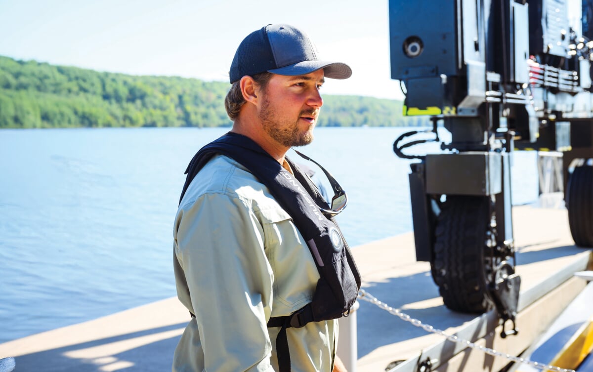
"What we're showcasing here is a modern approach to mapping all of our Great Lakes at very high resolution in terms of lake bed bathymetry," says Travis White, GLRC research engineer and project lead on the mission. "That's a really important objective for our Great Lakes states for many different reasons. One is preserving the cultural assets, such as missing shipwrecks, airplanes, and relics from Paleo people who lived along the ancient shorelines of our Great Lakes, below where our modern waterline is today. There's also a lot at stake here for navigation, safety, and commerce, in addition to the technology that we're trying to move forward."
Big Lakes, Big Challenges
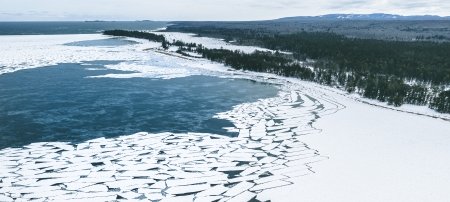
The Great Lakes have more than 10,500 miles of shoreline—a distance equivalent to 20 round-trip drives between Houghton and Detroit. Lake Superior's shoreline accounts for 2,726 miles of that total, along with 31,700 square miles of surface area and an average depth of almost 500 feet—far too deep for human divers. The challenges of finding much of anything in such an imposing search area were not lost on Wayne Lusardi, marine archaeologist for the State of Michigan, who traveled to Houghton to help with the search.
On the GLRC docks, Lusardi told the story of the NCAR plane's disappearance to the search team. "We know it's out there," Lusardi said. "We know it's in this general vicinity, but the aircraft is very likely not intact, based on the wreckage that has been widely distributed across the lake bed in water that's up to and over about 400 feet. So it will be a difficult search, but unlike the 1969 sonar survey, we have the technology today amassed right here, and the experts to utilize that technology, to make the best effort so far to come across some kind of positive conclusion to this search."
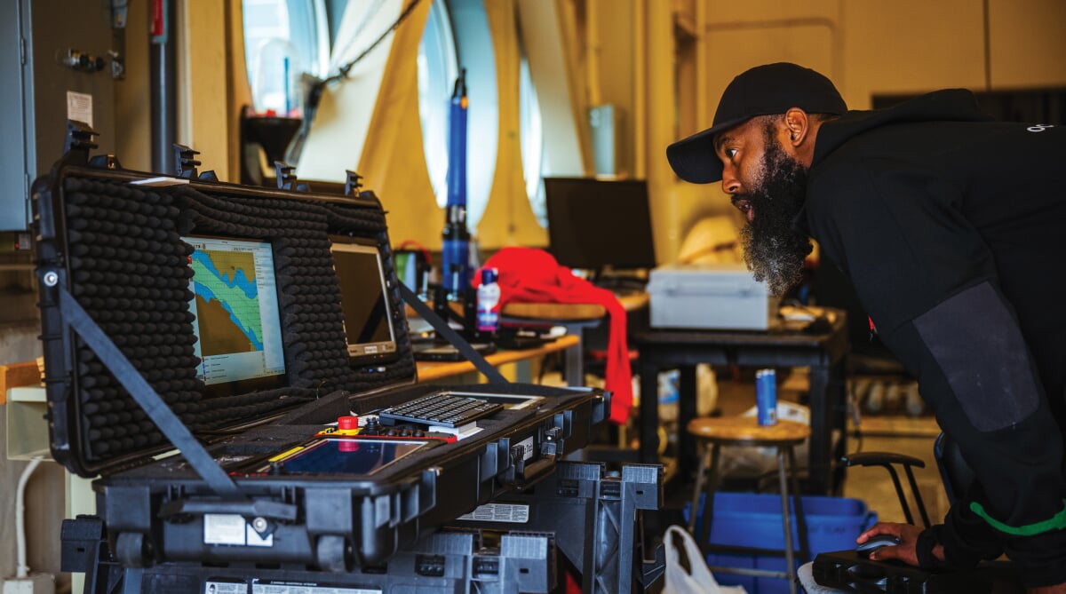
The Ocean Infinity ASV acted as a force multiplier for the mission. Gathering data at the same time as Michigan Tech's crewed RV Soliton, and also along the full distance of its transits in and out of the search area each day, the Armada 8 effectively doubled the search team's area of coverage. The sonar systems aboard enabled the intake and display of real-time high-definition bathymetric images with overlapping coverage from throughout the search area—images that were livestreamed to an online audience of curious observers, including family members of the missing flight crew and reporters from media outlets around the country.
The Great Lakes in Great Detail
Perhaps surprisingly, only 15 percent of the lake beds of the Great Lakes have been mapped at high density. Though many maps of the Great Lakes do display some bathymetry, most are made from low-density data that in some cases is decades old. The contour lines we see on these maps often do not accurately represent what the lake bottom actually looks like.
Greater understanding of the lake beds through better, more comprehensive bathymetry is the key to effective management and preservation of the complete underwater landscape. The importance of such knowledge is hard to overstate—particularly as both a changing climate and a growing "blue economy" in the Great Lakes continue to impact and shape the region.
The Great Lakes Observing System (GLOS), one of the primary partners of the Smart Ships Coalition, is leading the effort to map the bottoms of the five big lakes. Employing advanced and often crowdsourced technology among a diverse team of stakeholders from government, industry, education, and recreation, GLOS aims to map all five of the Great Lakes at high density—and they want to do it quickly. Hence the name of their ambitious initiative: Lakebed 2030.
"Lakebed 2030 is an initiative to fully map and explore the Great Lakes in their entirety in high resolution and high detail," says Tim Kearns, chief information officer of GLOS. "The MTU-led search for the missing NCAR plane is a great model that could be replicated elsewhere in the Great Lakes and beyond—the combination of crewed and uncrewed technology to look for features on the seafloor and contribute to the Lakebed 2030 initiative."
-
$500Mestimated regional cost of coastal erosion and flood damage to cities in 2019
-
$7Bannual value of all Great Lakes fisheries
-
40Mpeople get their drinking water from the Great Lakes
GLOS estimates the cost of mapping all five Great Lakes in high density to be $200 million. That's quite the modest investment relative to the value the lakes provide. The Great Lakes basin supports 34 million people and more than 3,500 species of plants, animals, and fish. The region's annual gross domestic product tops $6 trillion.
It's important work. And it's the kind of work Michigan Tech researchers are uniquely positioned to lead.
Mission Complete
Mother Superior graced the search team with five straight days of fair September weather. They exceeded their initial goals and mapped 29 square miles around their primary search area, plus 16 square miles along their transit lines in and out each day—a total of 45 square miles. Preliminary sonar data identified over 30 potential targets worthy of further investigation, one of which had a form factor suggesting some sort of wreckage or other large debris. Real-time and follow-up data post-processing, however, did not definitively identify the missing NCAR plane.
Although the plane remains missing, the mission was still a success. The comprehensive, high-resolution map created by the team shows previously unidentified bedform geology and glacial features of the search area—one more puzzle piece slotted into place in the effort to map all of the Great Lakes. It's another big step forward, says White, in the Smart Ships Coalition's effort to make the Great Lakes–St. Lawrence region a global hub for research and development of freshwater marine autonomy.
"Where this may all be heading in a few years' time is potentially looking at something like this ASV being capable of going out over the horizon, with folks here at the GLRC or elsewhere operating it persistently for days or weeks on end," says White. "We're currently discussing strategies with GLOS and other Smart Ships Coalition partners to continue the momentum to support future mapping, exploration, and technology demonstrations in Lake Superior and other Great Lakes, all toward fulfilling the mission of Lakebed 2030. And of course, it's 2025. The time is already short to meet that goal."
Smart Ships Coalition
The Smart Ships Coalition of the Great Lakes–St. Lawrence unites more than 60 universities, state and federal agencies, private and nonprofit companies, and international organizations that share a common interest in the advancement and application of autonomous technologies operated in marine environments. In addition to Michigan Tech’s Great Lakes Research Center, the Smart Ships members and others who contributed directly to the mission to search for the NCAR plane were:
- Great Lakes Observing System
- Great Lakes Shipwreck Historical Society
- Great Lakes St. Lawrence Governors & Premiers
- Interlake Maritime Services
- Kongsberg
- Michigan Department of Environment, Great Lakes, and Energy
- National Museum of the Great Lakes
- National Oceanic and Atmospheric Administration
- Norbit
- Ocean Infinity
- QPS
Michigan Technological University is an R1 public research university founded in 1885 in Houghton, and is home to nearly 7,500 students from more than 60 countries around the world. Consistently ranked among the best universities in the country for return on investment, Michigan's flagship technological university offers more than 120 undergraduate and graduate degree programs in science and technology, engineering, computing, forestry, business, health professions, humanities, mathematics, social sciences, and the arts. The rural campus is situated just miles from Lake Superior in Michigan's Upper Peninsula, offering year-round opportunities for outdoor adventure.