Background
The Michigan Department of Transportation (MDOT) has been working on meeting the Federal
Highway Administration (FHWA) requirements for the Model Inventory of Roadway Elements
(MIRE). More information about the MIRE program can be accessed at the United States' DOT website.
- Previous state GIS road layer does not have road surface type for over half of Michigan roads, as of 2022
- There are over 122,000 centerline miles of public roads
- 92% managed by over 600 local agencies in Michigan, 21% of this is federal aid eligible
Methods
We built from the methods originally established to analyze high-resolution, 4-band imagery to identify paved vs. unpaved roads.
Brooks, C.N., Dean, D.B., Dobson, R.J., Roussi, C., Carter, J.F., VanderWoude, A.J., Colling, T. and Banach, D.M., 2017. Identification of unpaved roads in a regional road network using remote sensing. Photogrammetric Engineering & Remote Sensing, 83(5):377-383
In Phase I of the MIRE project, we assessed three artificial intelligence (AI) models for pixel classification of paved vs. unpaved:
- XGBoost (fastest, accurate) – XGB (selected as our AI/ML tool)
- Random Forest (slower, accurate) - RF
- Gaussian Copula (lower accuracy) – GC

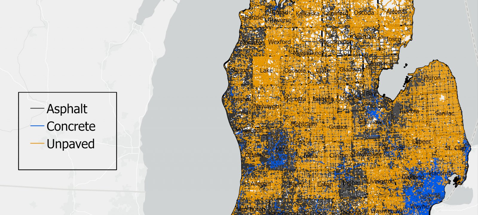
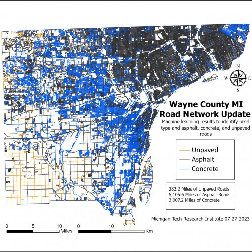
In Phase 2, we added Concrete vs. Asphalt classification and addressed the issue of roads not aligned with imagery.
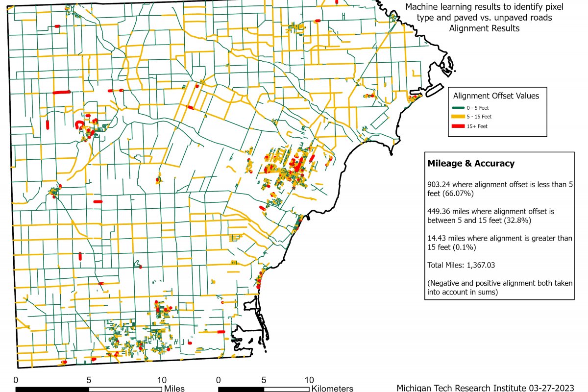
Results
Results were generated for all lane miles in Michigan.
- Work completed in August, 2024 and all data delivered to MDOT, with ESRI-compatible metadata
- Mean F1 accuracy score was 95.7% for asphalt, 67.3% for concrete (more challenging), and 80.2% for unpaved roads
- Mapping totaling 93,713.4 miles of asphalt roads; 8,652.3 miles of concrete roads
(102,366 miles paved total), and 43,385.8 miles of unpaved roads.
- Surface type identification for 145,752 miles total
- Surface type identification for 145,752 miles total
- Results were approved for a poster presentation at TRB 2025
- Methods are expandable to other states and countries

Publications
You can read more about the project's methods, analyses, and outcomes in this publication for the project.
Brooks, C., Sawtell, R., Redhuis, D., Janiszewski, S., Chavez, A., Barber, V., Dobson, R., Graham, J., Colling, T., Kozsykowski, N., LaCost, A., Deljevic, G., Jenkins, A., Toth, M., Himmelein, A. 2025. Updated Methods for Identification of Road Surface Type using Machine Learning-Enabled Remote Sensing. Proceedings of the Transportation Research Board 104th Annual Meeting, 20 pgs.