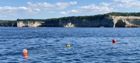
A new buoy and a permanent installation of high-frequency radar masts add further monitoring to the Straits of Mackinac.
The Straits of Mackinac are known for their turbulent currents, making the monitoring of waves and weather crucial in the busy and important Michigan waterway. This spring and summer, a new buoy and a permanent high-frequency radar system will add to the methods of remote observation of the narrow Straits.
In 2019, Lorelle Meadows, research associate professor in Michigan Technological University’s Department of Cognitive and Learning Sciences and founding dean of the Pavlis Honors College, realized a lifelong dream to install two temporary high-frequency radar masts on the north and south shores of the Straits. The pilot study was funded by the Great Lakes Observing System (GLOS).
“We chose the Straits for its strategic importance,” Meadows said. “It’s imperative for us to have the best technology available for environmental monitoring, search and rescue, shipping and other important applications that rely on a more complete understanding of the currents in this complicated area.”
From Salt Water to Fresh Water
High-frequency radar is a shore-based remote sensing system used to measure currents offshore by sending a low-power electromagnetic pulse over the water. The electromagnetic wave interacts with marine surface waves, which scatter the radar signal. By measuring the electromagnetic pulse as it bounces from marine waves back to the radar mast, researchers are able to map the speed and direction of the underlying currents.
Though already common along the country’s ocean coasts, the two masts are the first high-frequency radar installation in the Great Lakes.
While high-frequency radar systems have been in use for some time in saltwater applications, their deployment in freshwater systems is less common because the pulse does not travel as far in the absence of salt, which acts as a conductor. That limitation, however, does not outweigh the benefits.
The hourly current maps and data from this system will also serve to enhance the advancing Great Lakes numerical hydrodynamic model with partners at the Great Lakes Environmental Research Laboratory of the National Oceanic and Atmospheric Administration (NOAA).
Grants and Funding
Funding agencies include the Great Lakes Observing System (GLOS) and the Michigan Department of Environment, Great Lakes, and Energy (EGLE).
Though not meant to replace buoys, the radar masts provide further data to gain better understanding of complex lake systems.
“A wide variety of modeling and other studies of currents in the Straits of Mackinac have shown that flow conditions are complex in this area," said Ana Sirviente, GLOS chief technology officer. “Understanding the water dynamics of this connecting waterway between Lakes Huron and Michigan is of vital importance because of its impact on the ecosystem and the economy of the entire basin. It is for these reasons that GLOS supports Lorelle Meadows’ team at MTU, as their work will result in new current data and insights at a level of detail previously unavailable.”
The organizations that manage the shore-based high-frequency radar system locations are the Mackinac Bridge Authority and the Mackinac Island Historical Park Commission, along with the Fort Michilimackinac. Meadows anticipates installation will be complete by the end of the summer.
Work It, Buoy
Michigan Tech’s existing buoy in the area, Straits West 45175, installed in 2015, collects wind direction, wind speed and gust speed, air and water surface temperatures, relative humidity, dew point, barometric pressure, solar radiation, significant wave height, dominant period of waves, wave direction and the current velocities beneath the buoy.

Data collected using high-frequency radar in the Straits of Mackinac, coupled with existing buoy data, gives scientists, municipal managers, the shipping industry, environmentalists, and government agencies a better picture of the Straits' infamously turbulent currents. Tomorrow needs high-frequency radar in freshwater systems.
The new buoy, installed in mid-April, is a Datawell Wave Rider, designated as Michigan Tech’s station 45194. The Wave Rider buoy is considered the international “gold standard” of wave measurements and is collecting detailed wave information, surface water temperature and near-surface current speed and direction. All data from both buoys are nearly instantaneously available to the public.
“The combination of two environmental monitoring buoys in the Straits, both within the footprint of the high-frequency radar masts, is both unique and provides unprecedented observations of the complex currents through this critical region,” said Guy Meadows, director of the Marine Engineering Laboratory and the founding director of the Great Lakes Research Center.
Ongoing remote observation of the Straits of Mackinac benefits many stakeholders by providing warnings to ships about currents that might force them aground or off course, giving vital information to search and rescue operations, tracking any hazard spilled into the water, monitoring harmful algal blooms to protect municipal water intakes, and potentially tracking ice floes.
Michigan Technological University is an R1 public research university founded in 1885 in Houghton, and is home to nearly 7,500 students from more than 60 countries around the world. Consistently ranked among the best universities in the country for return on investment, Michigan's flagship technological university offers more than 120 undergraduate and graduate degree programs in science and technology, engineering, computing, forestry, business, health professions, humanities, mathematics, social sciences, and the arts. The rural campus is situated just miles from Lake Superior in Michigan's Upper Peninsula, offering year-round opportunities for outdoor adventure.


Comments